
The Red Cross provide lunch and dinner to staff on the site. The food is good - I have eggs and bread and some very-strong tar-like coffee. Throughout the day I am introduced to the various elements of the integrated project - Logistics, Shelter, Livelihood, WATSAN and Communications. Each team is headed by a Manager and a Delegate and around 10 or so local Haitian staff. Melvin is the head of delegates for the team.
Despite being an 'integrated' project it quickly becomes apparent that not only are each of the teams physically separated from each other in their own shipping containers but they're also working very separately from each other as well. This is an issue acknowledged readily by the staff themselves. As a result, I find a significant amount of in coordination and duplication in terms of data collection and data management.
 After meeting some of the Delegates I establish that an integrated survey was collected at the beginning of 2011 containing baseline information on shelter, WATSAN and livelihoods. This survey was used to build a Beneficiary Profile for the project. I will try and sumarise the results of this survey in a future post to give a description of the social and physical status in Delmas 19 at the moment.
An enumeration survey was also conducted for shelter to capture more information about the people living in the area and to determine the ownership situation for each plot. Land ownership is a hugely complex issue in Haiti. Delmas 19 alone contains a mixture of land owners, house owners, renters and squatters.
Finally, a detailed cadastral survey has also been conducted by a Haitian survey team on the ground. This survey has mapped the building plots across Delmas 19 and will be used as the framework for the GIS. It will also be used when re-planning the layout of the neighbourhood. Delmas 19 is a slum in the centre of Port-au-Prince. My remote analysis of Delmas 19 using aerial imagery revealed that the average building size in Cite 4 is 34.8m-2. The building plots are very unequally divided. During the planning phase the team hope to create more equally-sized plots with a more regular layout. The following map shows the results of the cadastral survey in Delmas 19:
 Each of these surveys uses different identifiers and duplicates many of the attributes. The livelihood survey contains no location information at all so it is impossible to locate any of the beneficiaries and it is difficult to identify households who may be trying to apply for a grant more than once. One of my first tasks will be to try and link the livelihood and shelter's enumeration survey using owner names so that the livelihood survey results can be mapped.
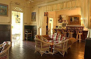
At the end of the day I am invited to go and see some live music. I'm driven with Melvin, Dave (logistics Delegate) and Martin (first-aid trainer) to Hotel Oloffson, a 19th century Gothic gingerbread mansion. The hotel was the real-life inspiration for the fictional Hotel Trianon in Graham Greene's famous 1966 novel The Comedians. The hotel is beautiful with a lovely wooden balcony but the wind and rain is too strong for us to stay outside. After a Prestige beer, the band come on - a mix of different influences led by the owner of the hotel. At 10pm the rain recedes and we head back home.
 On the way we're caught in a huge storm and flash flood. Within minutes of torrential rain, the roads are full of torrents of water, rubble and plastic. The landrover navigates this well but the cars in-front of us with water up to their bonnets don't fair as well. Rubble still lines the streets and is washed into the middle of the streets everytime there is strong rain. This creates a hazard for pedestrians walking in the area.
No comments:
Post a Comment